Experimental Ocean and Coastal Ecosystem Accounts for Norwegian Municipalities (EOCEAN)
EOCEAN is combining innovative solutions for mapping coastal ecosystems and producing ecosystem accounts to help fill current knowledge gaps for coastal management in Norway.

- Project period
- -
- Funders
- The Research Council of Norway
- Total budget (NOK)
- 12,500,000
- Research section
- Water and society
- Contact persons
-
 Laura Friedrich
 Camilla With Fagerli
 Dag Øystein Hjermann
 Debhasish Bhakta
 Hege Gundersen
 James Edward Sample
 Jemmima Knight
 Kasper Hancke
 Kristina Øie Kvile
 Medyan Esam Ghareeb
 Nicolas Dupont
 Trine Bekkby
 Trygve Heide
 Viviane Girardin
About the project
EOCEAN aims to map coastal ecosystems and build ecosystem accounts using innovative drone and satellite technology. Together with our local authority partners, we want to find out how these maps and accounts can support better coastal management across the land-sea interface. Local authority partners in EOCEAN are Karlsøy Municipality, Møre og Romsdal County Council, Arendal Municipality and Larvik Municipality..
When it comes to managing nature along the coast, Norwegian municipalities are currently flying blind. The ecosystems found along Norway’s coast are important for our economy, health and wellbeing. Yet, we know very little about where kelp forests, seagrass beds, coastal meadows and other key habitats are, or what their ecological status is. This makes it difficult for local authorities to make sustainable decisions about natural resource use, infrastructure development, nature restoration or conservation priorities.
EOCEAN aims to significantly advance the use of remote sensing technologies and ecosystem accounting to improve sustainable marine management and spatial planning in Norwegian municipalities.
The project has four objectives:
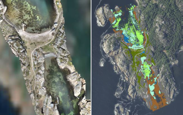
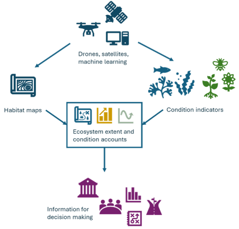
1) Map coastal ecosystems using drones, satellites and machine learning to produce ecosystem extent accounts.
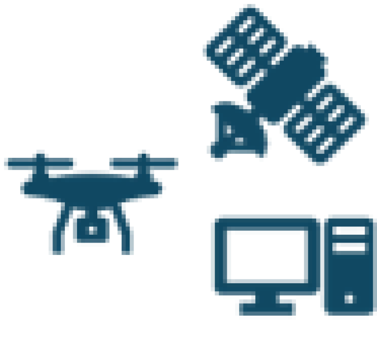
EOCEAN will use the SeaBee drone infrastructure (seabee.no) to produce ultra-high resolution local habitat maps. These maps will then be upscaled to regional scale for our partner municipalities using Sentinell-2 satellite images and machine learning. Coastal ecosystems on land and at sea will be mapped back in time with the help of historical satellite images.

With the regional maps, EOCEAN will build ecosystem extent accounts at the municipality scale. The maps and extent accounts will provide our municipality partners with key information about the spatial distribution and area of important coastal ecosystems and how these are changing over time.
2) Develop methods for measuring and monitoring coastal ecosystem condition to produce ecosystem condition accounts.
EOCEAN will develop a methodology for regular mapping and monitoring of coastal ecosystem condition. The focus will be on condition indicators that would enable the production of coastal ecosystem condition accounts. Condition accounts will provide the municipalities with valuable information about how the health of their coastal ecosystems is evolving over time, reflecting impacts from human pressures or management measures.
EOCEAN is particularly interested in exploring options for monitoring condition of coastal ecosystems using drones and satellite images. Remote sensing of key condition indicators could make regular monitoring of coastal ecosystems more feasible and cost-effective.
3) Test innovative coastal governance accounts and demonstrate the management relevance of ecosystem accounts.


Governance accounts are a new concept developed by the Global Ocean Accounts Partnership. The idea is to spatially map governance arrangements, including policies, regulations and key institutions, and record changes in these arrangements over time. Using the same spatial map base as ecosystem accounts allows to assess changes in ecosystems in connection with changes in governance arrangements.

EOCEAN will develop a theoretical framework for coastal governance accounts for Norwegian municipalities and test this framework in our partner municipalities. Through these coastal governance accounts, we also aim to demonstrate the usefulness of coastal ecosystem extent and condition accounts for spatial planning and management decisions in the coastal zone..
4) Build capacity in the use of geospatial data and coastal ecosystem accounts.
EOCEAN is working with innovative technologies and methods for coastal drone-based research and ecosystem accounting. Tailored training and close, interdisciplinary collaboration between researchers and practitioners are key for success.
EOCEAN is organising a series of practical workshops with three objectives: 1) to provide training on the development and use of coastal ecosystem maps and accounts, 2) to collect input from our local authority partners on their information needs as well as validation of project results and output design, and 3) to disseminate the maps and accounts produced by the project.
EOCEAN is a three-year collaboration project (2026-2028) led by NIVA and financed by the Research Council of Norway. The project involves four research partners: NIVA, the Norwegian Institute for Nature Research (NINA), the Norwegian Computing Center (NR) and the Royal Belgian Institute of Natural Sciences (RBINS); and four local authority partners: Karlsøy Municipality, Møre og Romsdal County Council, Arendal Municipality and Larvik Municipality.
Follow EOCEAN on LinkedIn